![Glacier Peak Wilderness [mt. Baker-Snoqualmie and Okanogan-Wenatchee National Forests]](/store/9781566955096.jpg)
National Geographic Maps
- Waterproof - Tear-Resistant - Topographic Map
National Geographic's Trails Illustrated map of Glacier Peak Wilderness is an essential travel companion for outdoor enthusiasts exploring this rugged area in the North Cascades of Washington. Expertly researched and created in partnership with the U.S. Forest Service and others, the map provides unparalleled detail of the wilderness area and parts of the Mt. Baker-Snoqualmie and Okanogan-Wenatchee National Forests. Also covered are the popular recreation areas Glacier Peak, Lake Chelan, Henry M. Jackson and Wild Sky Wilderness Areas, Skagit and Suiattle Wild and Scenic Rivers, Entiat Mountains, Pacific Crest Trail and Lake Wenatchee State Park.
With over 450 miles of trails, the area has endless recreational opportunities. Trails are marked according to their designated usage, whether you're exploring on foot, skis, horseback, mountain bike, ATV or snowmobile. Other recreational points of interest pinpointed include campgrounds and campsites, trailheads and interpretive trails, sno-parks, cross-country and downhill ski areas, fishing holes, boat launch sites and shelters. The map includes contour lines, elevations, labeled peaks and summits, glaciers, water features, numbered Forest Service roads, selected waypoints and clear boundaries between wilderness and national forest land. Also provided are general background information, wilderness regulations, safety tips and essential contact information.
Every Trails Illustrated map is printed on Backcountry Tough waterproof, tear-resistant paper. A full UTM grid is printed on the map to aid with GPS navigation.
Other features found on this map include: Bonanza Peak, Chelan Mountains, Entiat Mountains, Fortress Mountain, Glacier Peak, Glacier Peak Wilderness, Henry M. Jackson Wilderness, Hidden Lake Peaks, Lake Chelan-Sawtooth Wilderness, Lake Wenatchee, Miners Ridge, Monte Cristo Peak, Mount Buckindy, Mount Logan, Mt. Baker National Forest, Nason Ridge, North Cascades, Okanogan National Forest, Pyramid Mountain, Snoqualmie National Forest, Snowking Mountain, Wenatchee National Forest, Whittier Peak, Wild Sky Wilderness.
- Map Scale = 1:75,000
- Sheet Size = 37.75 x 25.5
- Folded Size = 4.25 x 9.25
member goods
notems store
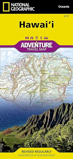
Hawai'i Adventure Travel Map
by National Geographic Maps - Adventure
Calendar/Blank Book /Folded$11.21
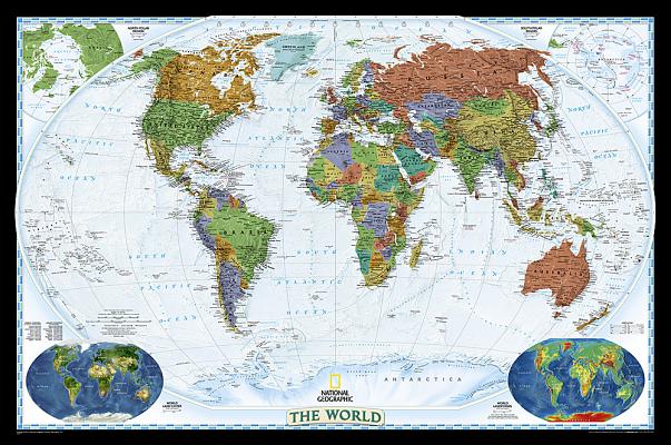
National Geographic: World Decorator Wall ...
by National Geographic Maps - Reference
Calendar/Blank Book /Not Folded$25.46
listens & views