National Geographic Maps - Reference
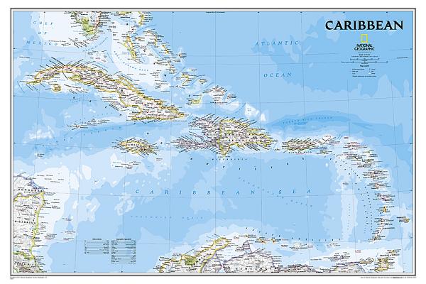
Includes over 1,000 named places including country capitals, primary and secondary towns; political boundaries, important infrastructure, and all key landforms. Useful and informative notes about the region's history and unique geography are spread throughout the map, providing the reader further understanding of the Caribbean's unique attributes.
The map is encapsulated in heavy-duty 1.6 mil laminate which makes the paper much more durable and resistant to the swelling and shrinking caused by changes in humidity. Laminated maps can be framed without the need for glass, so the frames can be much lighter and less expensive.
- Map Scale = 1:3,286,000
- Sheet Size = 36" x 24"
member goods
notems store

Capitol Reef National Park
by National Geographic Maps - Trails Illust
Calendar/Blank Book /Folded$11.21

listens & views