Rand McNally
product information
Condition: New,
UPC: 9781946494139,
Publication Date: Thu, March 1, 2018,
Type: Calendar/Blank Book ,
description
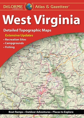
3With an incredible wealth of detail, DeLorme's Atlas & Gazetteer is the perfect companion for exploring the West Virginia outdoors. Extensively indexed, full-color topographic maps provide information on everything from cities and towns to historic sites, scenic drives, trailheads, boat ramps and even prime fishing spots.
With a total of 46 map pages, the Atlas & Gazetteer is your most comprehensive navigational guide to West Virginia's backcountry.
Full-color topographic maps provide information on everything from cities and towns to historic sites, scenic drives, recreation areas, trailheads, boat ramps and prime fishing spots.
Extensively indexed.
Handy latitude/longitude overlay grid for each map allows you to navigate with GPS.
Inset maps provided for major cities as well as all state lands.
Product Details: West Virginia State
Dimensions: 15.5" x 11".
AVAILABLE FOR ALL 50 STATES
member goods
No member items were found under this heading.
notems store


listens & views


CHRISTMAS ROCKPARTY 2013 / VAR ...
by CHRISTMAS ROCKPARTY 2013 / VAR (GER)
COMPACT DISCout of stock
$27.99

Return Policy
All sales are final
Shipping
No special shipping considerations available.
Shipping fees determined at checkout.